A Look at New York’s Reservoirs
© Marko Kokic
Most of the Tri-State area, including New York City, is now in a severe drought, according to the U.S. Drought Monitor.
On November 15, 2024, the NYC Water Supply System was at 61% of its capacity. The normal level for November 15 is 79%.
Aerial view of Cross River Reservoir, November 14, 2024. © Kevin Suttlehan
If you have ever driven past a reservoir during a drought, you know how severe the images can be.
As photographers, much of our previous work has been the result of natural disasters resulting from extreme weather—tornados, hurricanes and floods.
Recently, we travelled to upstate New York to photograph the effects of the current drought on New York City’s two reservoir systems:
the Delaware System, a network of six reservoirs in the Catskill Mountains and
the Croton System of reservoirs in Putnam and Westchester Counties.
Here are the images.
Low water levels and a wildfire in the hills overlooking Rondout Reservoir, November 8, 2024. © Marko Kokic
In the Catskill Mountains, 100 miles from New York City, we were a short distance from Rondout Reservoir when we first saw smoke ahead of us in the mountains. As the winds picked up, roads were closed down and firefighters from nearby towns began to arrive to fight a wildfire that was making its way up a hill overlooking the reservoir.
A rowboat sits tethered well above the waterline at Neversink Reservoir, November 8, 2024. © Marko Kokic
Nearby, at Neversink Reservoir, we saw the most extreme views, resulting from a combination of:
the current drought, and
the intentional lowering of the reservoirs in the Catskill Mountains in advance of the final phase of a decade-long, $2 billion tunnel repair project to fix underground leaks. You can learn more about that project here.
Aerial view of Neversink Reservoir, November 8, 2024. © Kevin Suttlehan
The Croton System
Fishing boats tethered along the shoreline of West Branch Reservoir, which appear to be at full level, November 14, 2024. © Kevin Suttlehan
In Putnam County, the West Branch Reservoir was the only reservoir we visited that appeared to be full.
This is how the remainder of the visited Croton System reservoirs looked:
Aerial view of the dam and shoreline of Titicus Reservoir in the Town of North Salem, Westchester County, November 14, 2024. © Kevin Suttlehan
The shoreline of Muscoot Reservoir, November 14, 2024. © Kevin Suttlehan
Aerial view of Cross River Reservoir, November 14, 2024. © Kevin Suttlehan
“I’ve lived here 30 years and have never seen it this low”—a passerby commenting on the water level of Cross River Reservoir, November 14, 2024. © Kevin Suttlehan
Part of the Croton River waterway at New Purdys, New York that eventually feeds into the New Croton Reservoir, November 14, 2024. © Kevin Suttlehan
New Croton Dam, November 14, 2024. © Kevin Suttlehan
Aerial view of the shoreline of New Croton Reservoir at New Croton Dam, November 14, 2024. © Kevin Suttlehan
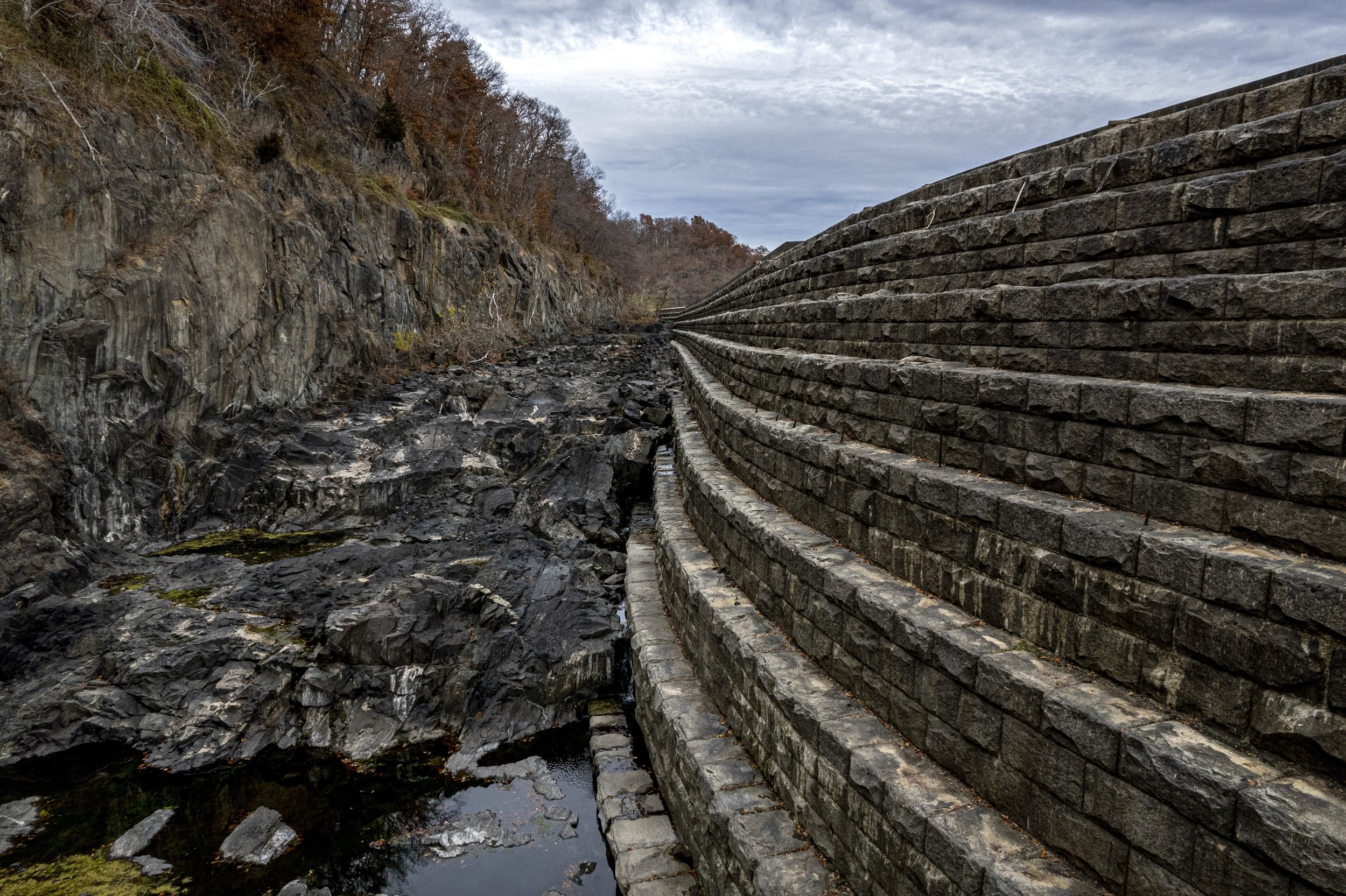
The spillway of the New Croton Dam, November 14, 2024. © Kevin Suttlehan
New York City uses about 1 billion gallons of water a day. To see current water usage and reservoir levels, go to: Reservoir Levels, NYC Department of Environmental Protection.
Close-up image of the spillway of the New Croton Dam, November 14, 2024. © Kevin Suttlehan
About Us
We are a New York-based photography services company specializing in crafting visual narratives for nonprofits and nongovernmental organizations (NGOs).
Cover Photo: Neversink Reservoir, November 8, 2024. © Marko Kokic


